A few years back Gaia Resources looked at the rise of drones (or Unmanned Aerial Vehicles if you prefer) and could see lots of potential for environmental applications. We also knew it wasn’t quite the right decision for us to pivot the company into piloting and acquisition, and instead positioned ourselves to focus on working with the data products that came from drone cameras and sensors (e.g. imagery, elevation models, video).
Maintaining our independent approach, we now have drone companies as partners, so that depending on the challenge an organisation is trying to address – whether related to agriculture, mining, conservation or planning applications for example – we can design a capture program and mobilise quickly. There’s also the question of appropriateness, and whether drone imagery is the right type of data for a particular challenge – and so we equally have the relationships with aerial and satellite providers to cater for a range of remote sensing needs (keeping to our technology-agnostic principles).
A number of clients have come to us to help them achieve better environmental outcomes through the analysis of drone captured data and development of software encompassing drone technology. In one project we worked with an environmental company to define technical processes that delivered regulatory compliance data products using open source GIS software. In fact our foray into turning this type of data into useful mapping products goes back to 2016 when my former colleague James was working up in Shark Bay with Aerial Environment to map mangroves (see this blog).
The main subject of this entry though is about some birds – the critically endangered Swift Parrot (Lathamus discolor) to be precise. One of our current clients, Wildlife Drones, spends their time radio-tracking these small migratory birds within their winter range to help shed light on their mysterious movements and improve conservation management. This ground breaking work, featured on the ABC news recently, was conducted using drones and sophisticated signal processing algorithms which overcomes the time consuming and labour intensive process of manual radio-tracking. Wildlife Drones’ latest radio-receiver system builds upon the outcomes from a previous research project that they recently published in Science Robotics.
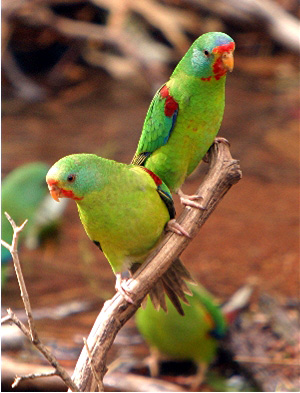
The Critically Endangered Swift Parrot. Image courtesy of the Canberra Ornithologists Group and Geoffrey Dabb.
Prior to meeting the guys at Wildlife Drones, the only thing I knew about drones and birds was that in the Pilbara the Wedge Tailed Eagles were taking down mining company drones on a weekly basis. So it was refreshing to see a company was applying this technology to learn more about the movement patterns of species like the Swift Parrot – a bird that responds to Australia’s “boom and bust” drought cycles by moving dynamically across vast areas of south eastern Australia.
Our team started working with a concept for a desktop app that could show the real-time coordinates of radio frequency tags on a base map. We were first engaged to run a one day hackathon-like exercise internally which resulted in a proof-of-concept viewer and a choice of technology that would be suitable for a more operational solution. Imagine a small set of core requirements, simulated radio tag location data, and three Gaia Resources teams working with three different technologies, with a pitch of the pros and cons of each on the second day.
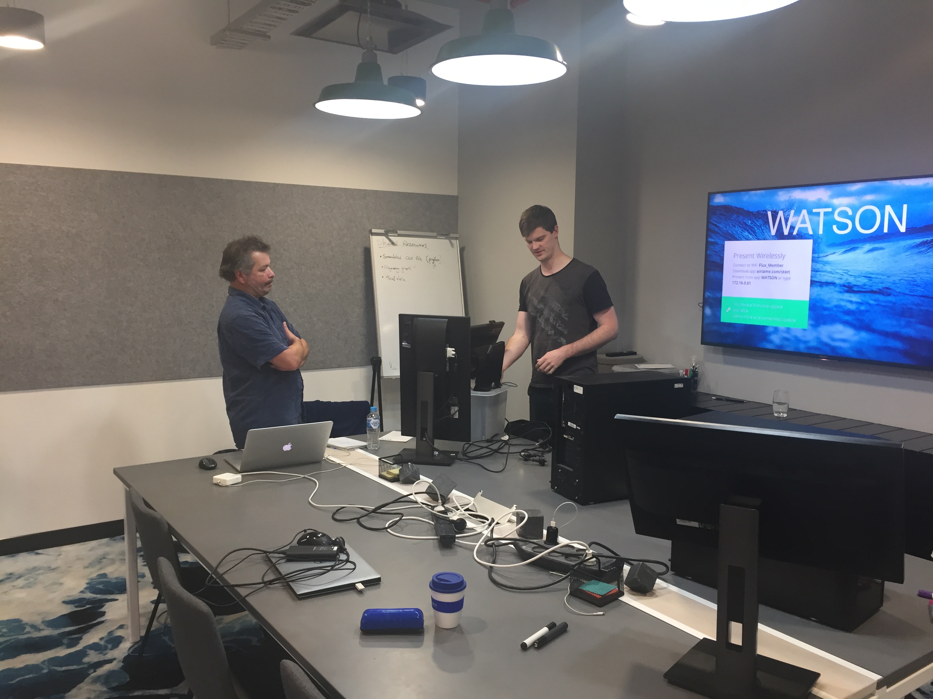
Serge and Sean breaking down the gear after an intense day of discovery hacking (above). The proof of concept Electron app displaying (simulated) real-time radio frequency tag positions.
As a result of this hackathon, we chose to work with Electron, which is a Javascript-based open-source framework allowing for the development of desktop applications using components originally developed for web applications.
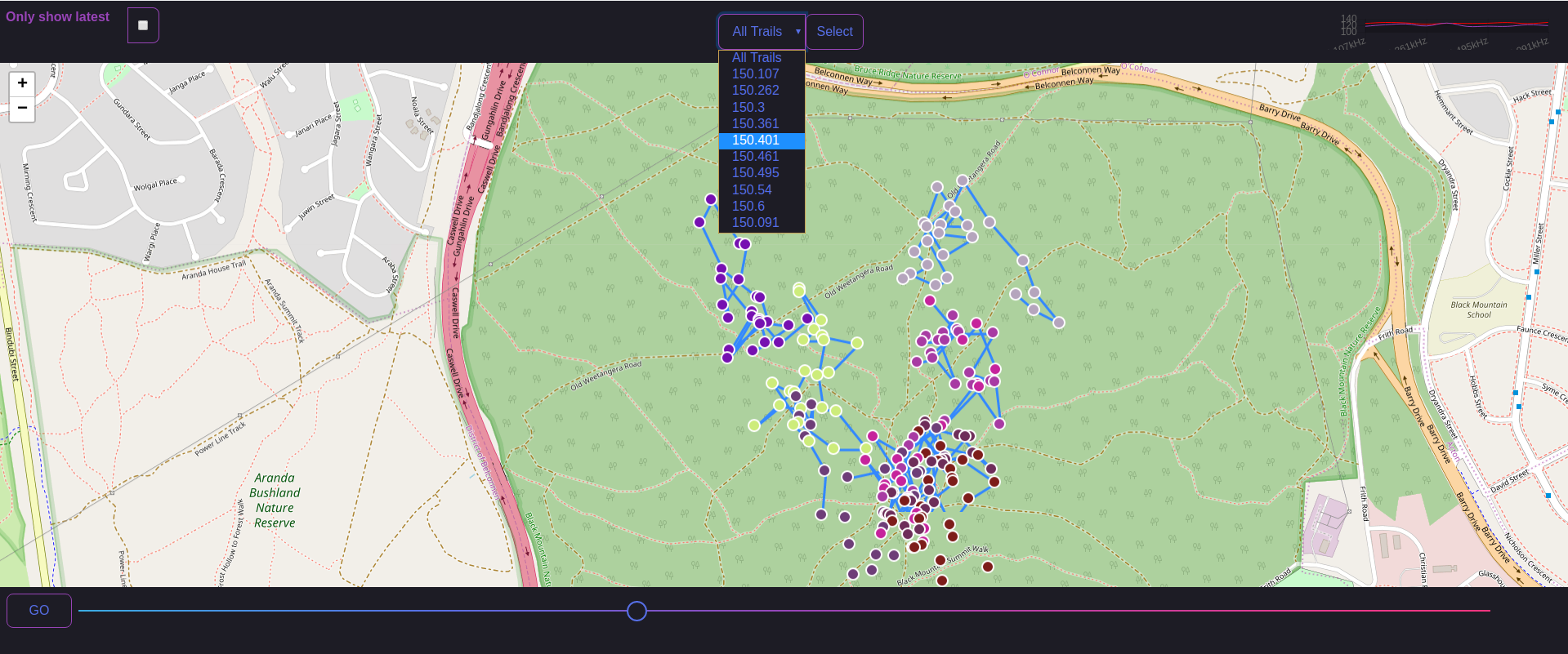
The larger project to bring this desktop app to life is happening now, and it has been really exciting to be part of its development. Voon-Li, Serge and Sean have worked hard through two Agile sprints to produce a wireframe app (based on designs by Tracey) and then steadily make the designed buttons and workflows functional. We now have offline map caching and online satellite imagery services, dynamic map data display of tag frequencies and charting, export features… the list goes on. In the next sprint we are set to tackle synchronisation with cloud server storage, authentication and drone base station controls. All along we have been working collaboratively with the brains trust at Wildlife Drones to understand what will and won’t work for their on-ground activities. A key aspect has been looking at the in-field and in-office use cases and working with an evolving ‘customer process.’ In particular is the requirement to provide an app that can function outside of mobile data range (e.g. within remote parks and reserves) but still provide full mapping and data collection capabilities, as well as synchronisation when back within mobile data coverage.
If you are interested in finding out more about what Wildlife Drones get up to, check out their website. Also feel free to reach out and start a conversation on the regular channels if you want to talk to us about drones, their suitability for your needs, and related data products. We can contacted by email, or via Facebook, Twitter or LinkedIn.
Chris
Comments are closed.