Today marks the launch of the NAFI Fire Information app by the team at Charles Darwin University (CDU) responsible for maintaining Northern Australia and Rangelands Fire Information (NAFI) system.
Gaia Resources worked closely with the NAFI team to design and build the app, which you can now download onto your device from the Apple Store or Google Play Store.
The release coincides with the 2021 Savanna Fire Forum being run remotely from Darwin to over 150 participants. Available for Android and iOS, the app enables land owners, indigenous rangers, conservation scientists, pastoralists and others to get near real-time fire information across 80% of the Australian continent. It is part of a bunch of support we have been providing to NAFI and other fire management groups in recent years (click here for a snapshot of previous blogs), and we are really excited about our contribution up in the Top End.
On the surface the app simply reflects the powerful data products available from the NAFI website that are already used extensively across projects and programs in the north of Australia to monitor savanna burning programs and bushfires. Fire scars are displayed representing remotely sensed burnt areas coloured by the month of the fire, as are thermal hotspots detected from an array of satellites. These data layers are presented in an intuitive mapping interface with a small selection of base maps, location and compass direction functionality.
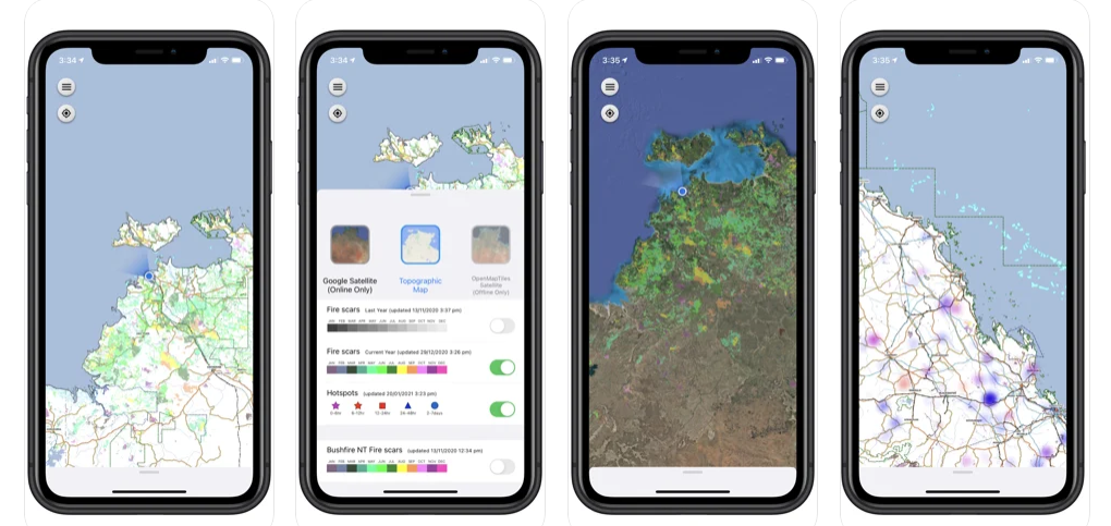
The NAFI app starts with a view of your region (left), presents a legend and layer selector (middle left), provides topo and imagery base maps (middle right) and near real-time hotpots (right).
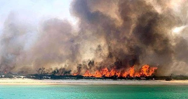
In this initial release, the idea is to get the data out there onto mobile devices, and the NAFI team are keen to have that drive discussion about enhancements that will deliver high value to people working in the field and planning their fire management activities. This could be planners and rangers on carbon abatement programs focused on early dry season controlled burns, or community and government organisations battling raging bushfires, like the one that swept through 87,000 hectares of the World Heritage Listed Fraser Island last December (here is a link to the most recent article on that event).
 |
 |
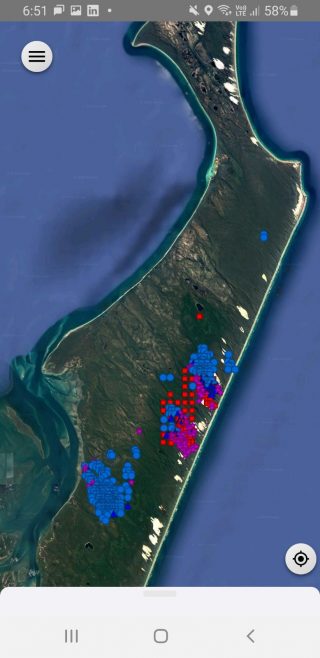
An earlier test version of the app (left) during the December, 2020 Fraser Island fire. Image source: The Australian.
When you start using the app, you’ll notice a few little gems in there that are all focused on increasing the accessibility and usefulness of that NAFI data. So let’s start with the near real-time aspect:
- the app checks for updates regularly, with hotspots updated every 20 minutes on average, and fire scars updated 2-3 times per week,
- data is pulled down dynamically from the NAFI server and processed on AWS cloud-based infrastructure,
- the data is then automatically uploaded to the person’s device whenever they have the app running with a mobile data connection.
Next, let’s consider the offline capabilities:
- the app allows you to download base maps (OpenMapTiles imagery or NAFI’s Topographic map) for your region(s) of interest,
- you can continue to work outside of a mobile data connection, with the most recent fire scar and hotspot data from when you were last online and had the app running,
- the location marker and compass direction give you geographical context online or offline.
Hundreds of thousands of hotspots are rendered seamlessly using a heatmap algorithm. To overcome a performance constraint for mobile devices, we have devised a rendering algorithm that can render tens of thousands concurrent hotspot points across Australia into temporal heat map clusters. People using the app can get that regional view of hot spots and visualise three different fire age groupings in purple (0-6hrs), red (6-24hrs) and blue (24-48hrs). The app also features some high resolution fire scar mapping of the Darwin area sourced from Sentinel satellite imagery, as part of a trial implementation with BushfiresNT. The continental scale fire scar mapping is based on MODIS satellite imagery (250m resolution), so the new Sentinel based mapping based on much higher resolution imagery is an exciting new space to keep an eye on.
Being an initial release, the NAFI team are looking for feedback future versions, or just to hear what you think – there’s a direct feedback link in the app itself too. We’d also love to hear your thoughts, so feel free to reach out to us and start up a conversation by sending me an email or getting in touch on Twitter, LinkedIn or Facebook.
Chris
Comments are closed.