A while back we posted about how we’d taken some town planning maps from the State Records Office of WA (SROWA) online archives (who we have been working with for a while) and made them into the interactive map shown below.
There’s a parallel story here – Damien Hassan from SROWA has been working on the same thing, and has published a blog on their site about their works on the historical sewerage plans.
Damien is actually one of our past QGIS trainees, and he came along to do our two day course some time ago, so that he could pick up the basics of QGIS and how to do the georeferencing. With QGIS being a free, open source package (you can go and download it right now from here) this made it a lot easier to get started for Damien. After doing our course, Damien went back to start working on georeferencing the historical plans. He’s set himself a pretty massive task, with there being 2,202 plans to work through!
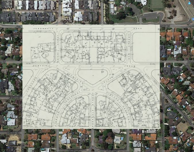
An example from Damien’s blog post
We’re also interested to hear from other people in the GLAM sector (galleries, libraries, archives, and museums) who might be interested in spatial tools for this sort of work. We are currently working through several new offerings for the GLAM sector, such as hosted collection management, archival management and digital preservation tools, and a custom GLAM QGIS course seems like something that might be of interest to a range of people!
We do have a QGIS course coming up next week, so get in touch with us if you want to get started on QGIS!
Drop us a line at training@gaiaresources.com.au, leave us a comment below, or start a conversation with us via on Facebook, Twitter or LinkedIn.
James
Comments are closed.