We’ve recently had the pleasure of building a new on-line spatial system for the Land for Wildlife program. Land for Wildlife (LFW) helps private landholders maintain habitat for wildlife on their properties, creating a network of native vegetation across Western Australia where wildlife can flourish.
The program is managed by the Department of Biodiversity, Conservation and Attractions (DBCA) and is delivered in partnership with seven regional Natural Resource Management (NRM) groups. The program currently has almost 2000 properties across Western Australia.
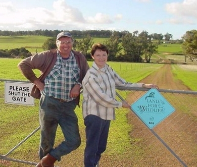
Land for Wildlife property owners, Robyn and Andy McElroy, at Boyup Brook – photo ©Parks and Wildlife
The team here at Gaia Resources are really excited to support this valuable nature conservation program by doing what we love – delivering sustainable technology solutions to make the world a better place.
We developed a web-based spatial system to manage information about the existing LFW properties and new applicants to the program.
The system allows DBCA and regional NRM officers to view and edit the data in an integrated system, with all officers able to see updates in real-time. This makes collaboration much easier, both within each group and across all eight organisations. It also saves officer time (previously information was stored across multiple formats and systems) allowing officers to focus on the landholders and wildlife conservation.
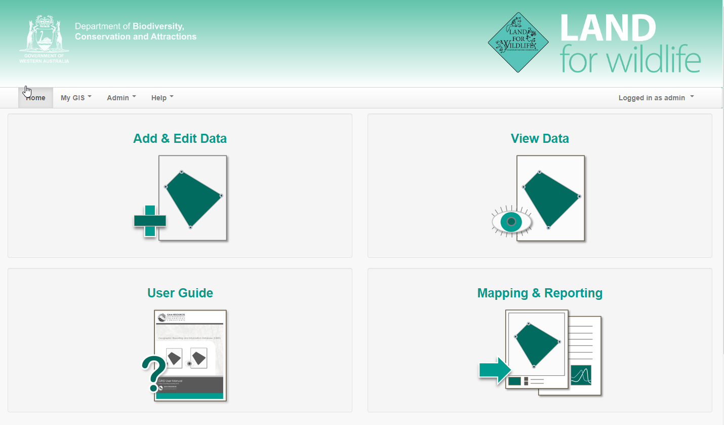
The LFW GRID allows real-time collaboration and centralised data management for many users across eight partner organisations
The system also has a new webpage for the public to register their interest in the program. This connects directly into the spatial system, so DBCA and NRM officers can see new applications in real-time.
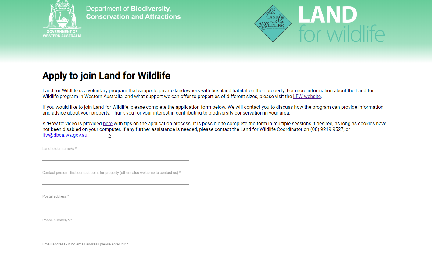
The LFW registration page submits data directly into the LFW GRID, visible to DBCA and NRM officers in real-time
We also set up the system to trigger an email to the LFW program coordinator and relevant regional NRM group as soon as a new application is submitted.
The system is based on our GRID product (Geographic & Reporting Information Database). This is an easy-to-use, online geographical information system (GIS) for regional NRM groups.
It allows regional NRM staff to record valuable information about NRM work in their region (for example, weed control, revegetation etc) and encourages real-time collaboration between staff within an NRM group, and across multiple NRM groups working on the same project.
GRID was originally developed for South West Catchments Council and is currently in use in seven NRM groups, and two other whole-of-state programs (State NRM and the Dieback Information Delivery and Management System).
GRID is a great example of how NRM groups can leverage and build upon each other’s investment in one system, resulting in a product that is tailored for each group’s specific needs but grounded in a common platform with which the vast majority of the NRM community are familiar.
For LFW we worked closely with DBCA, Peel-Harvey Catchment Council (PHCC) and the other regional NRM groups to tailor this version of GRID to suit the workflow and partnership-based delivery of the LFW program. This work was completed as part of a State NRM Program funded project, managed by the PHCC and DBCA.
If you’d like to know more about GRID and how it can help you improve collaboration and efficiency in your organisation and partnerships, please send me an email or start a conversation via Facebook, Twitter or LinkedIn.
Gill
Comments are closed.