I did mention in my last blog that my brain was fizzing away about Archives… so much so, that when I gave my recent radio interview about Gaia Resources, I ended up talking to the producer about how they take live streams of radio and convert them into digitally preserved archives (that’s yet another blog for the future).
So, I spent most of the weekend in my sick bed (man flu, I barely survived!) and I’ve had several early morning teleconferences with a bunch of spectacularly interesting people and companies around the Archives sector. One of the things that struck me was how we were already doing some work mapping where “things” in the Archives were, like this one below, where we took some open access copies of old town maps from the State Records Office of WA, and georeferenced them to create this:
(As an aside, I’ve been looking recently at how we can use georeferenced maps in a digital preservation environment – something akin to a different ‘type’ of “access copy” upload into a mapping system. More on that in the future).
More recently, we’ve delivered the example project for our Discovering Queensland project, where we put some of the archival images from the Queensland State Archives and put them into a map (as well as show these photos up against the latest Google street view) like this:
So there are two examples of mapping the Archives that we’ve done in the past… and we’d love to do some more of these, so we’re looking around for more projects and data to georeference.
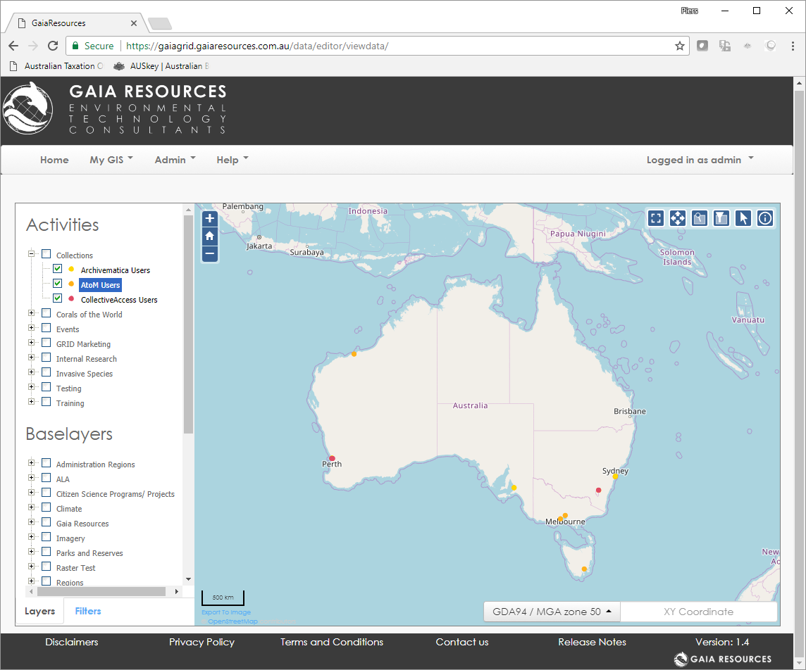
However, on the weekend I decided to map the Collections are that are using open source tools, like CollectiveAccess, AtoM and Archivematica (and this is what I mean by mapping the “Future”). While it was pretty easy to do some of these (certainly the groups we work with, anyway!), it’s certainly not comprehensive yet – so I need some help.
If you do use an open source software package for managing your collection, then please drop me a line directly via email (piers.higgs@gaiaresources.com.au) letting me know that you use it, to add to the map!
I’ll also be posting this in the usual channels – Facebook, Twitter or LinkedIn – as well as some of the forums and so on that have been made like the Google Groups for Atom and Atom Users in Australia – to see if I can work out exactly how many colleagues we have out there that are already embracing the open source initiatives around collections. Anyway, here’s a preview of what I did on the weekend (I used our GRID online GIS implementation for the mapping, as I could to that from my browser without having to think).
So I’m really hoping that I get some traction here to be able to start collating who’s using the software – and we’ll make this a feature on our website so that we can make this readily available to everyone who wants to see.
Piers
Comments are closed.