Perth is about to host the FOSS4G Oceania Conference (Perth Hub) on 12-13 November 2021, and up here in Darwin I’m just a tiny bit disappointed I can’t go along to take part. My office buddy Tom Lynch will be heading there to give a presentation, which I’ll talk a bit more about later, as will a number of former friends and work colleagues.
FOSS4G is short for ‘Free and Open Source Software for Geospatial’ – it’s a great convergence of people who are passionate about open source software and open geospatial data, and want to share their experiences. It’s safe to say we all see the business value and the opportunities for innovation and for creating good in this world through sharing and collaborating.
Maybe you haven’t heard the terms open source or open data before, or perhaps you’ve heard them in comparison to Commercial Off The Shelf (COTS) – or proprietary – products? In either case, let’s have a look at what a few of these terms mean:
- Open source software is where the copyright holder grants users the rights to use, study, change, and distribute the software and its source code to anyone and for any purpose. Often source code will be collaborated on and shared through public channels like GitHub.
- Open Data is the concept or commitment to make data products freely available to everyone to use and republish as they wish, without restrictions from copyright, patents or other mechanisms of control.
- Open API is an open Application Programming Interface specification for describing, producing and consuming web services. It allows organisations to open up controlled gateways into their systems, and encourage third parties to build integrations into their own applications.
There are some truly massive open source software projects out there that are breaking new ground and really challenging the COTS providers for functionality and benefits. In the spatial realm QGIS desktop software and PostGIS relational databases provide free and open source equivalents to COTS products. In statistics, we make use of products like the R Project, and in software engineering you see Python, PHP, and other open source programming languages everywhere. Even on relatively closed software products, there is a trend to create open APIs so that systems can more easily integrate and exchange data.
A nice example of QGIS and Python development is what Tom will be talking about at FOSS4G in relation to our involvement with the Northern Australian Fire Information program. The NAFI website has for several years built up an impressive array of fire related data products and services that support land managers (see our previous blogs). For the NAFI QGIS plugin, we leveraged the QGIS open source plugin framework to create a quick access tool for the folks who rely on that desktop package for fire management activities.
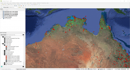
The NAFI QGIS plugin places a quick layers panel to the left for easy access to data layers.
We are also close to releasing another plugin that streamlines fire scar mapping tasks for Bushfires NT staff in the Northern Territory using Sentinel imagery from the European Space Agency (another free data product).
It’s not just feature parity and lower price that makes these open source products appealing—it’s also the flexibility and community-driven development opportunities they offer that allow organisations to build their own software interfaces, plug-ins, models and extensions to tailor functionality to meet real business needs.
Increasingly, government agencies publish “open data portals” like data.gov.au as an entry point to gaining easy access to FAIR data extracts and web services – by FAIR we mean data which meet principles of Findability, Accessibility, Interoperability, and Reusability. The Open Geospatial Consortium standardised web service formats (e.g. WMS, WMTS, WFS) these agencies publish to are a lynch pin in so many spatial systems out there. They recognise that FAIR data and open source software availability can kick start and accelerate a range of innovative products and applications they could only guess at.
If you are in a business evaluating software solutions – and I have been on both sides of that supplier-buyer fence – your decision process likely involves evaluating against a number of business risks. I would say that a well-supported open source product could have a lot to offer in terms of reducing those risks:
| Risk Area | Reframed |
| Functionality: will this open source product meet all of our business requirements and needs, or cost extra in customisations? | Does the open source solution meet the majority of our requirements, and allow us to focus otherwise sunken licensing costs on features tailored to our needs? |
| Financial: what will be the Total Cost of Ownership (TCO) for this open source system over X years, including support, training, maintenance and infrastructure? | Understand how the open source solution stacks up in terms of TCO, also taking into account licensing, annual maintenance and other costs that don’t apply. |
| Operational: will the open source solution help us meet our objectives for streamlining and delivering new capabilities? | Fair question – does the open source solution offer a framework for building tools, apps and web-based solutions? |
| Support: Who can we depend on for support when there is no vendor? | Rather than vendor support, consider that you have access to a community of users and consultants who can provide support. Not to mention looking at the skills within your team to support the solution internally. |
Other questions worth considering are: how many users are there actively using the product? How often is it updated? Do others find it easy to learn and use? What skills do you need to build on it? All the same questions you might ask of a COTS product, to be honest.
When you make the choice to use a product like QGIS or to build your own open source solution, know that there is a whole community out there (including us!) willing to lend a helping hand. For whatever challenge you have, chances are that there is someone that has tackled something similar, and has shared a solution or developed a script or plug-in, where you can save time and potentially add value back.
I really hope everyone heading along to the FOSS4G conference has a great time, and comes away with a basket full of ideas and new connections in their open geospatial journey. If you’d like to strike up a conversation, please feel free to contact me or hit us up on Twitter, LinkedIn or Facebook.
Chris
Comments are closed.