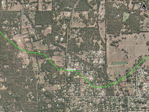
Overview
Gaia Resources was engaged in the first half of 2022 to conduct a multi-criteria analysis in order to create a set of proposed wildlife corridors for the Shire of Mundaring. The corridors connect patches of vegetation – sometimes called ‘stepping stones’ – across the Shire through the spatial analysis of Urban Monitor native vegetation, LiDAR derived stream networks, land use categories and roads. Not specific to a particular species, the aim of the proposed corridors was instead to increase connectivity and overall biodiversity, and to better inform the Shire’s planning processes and engagement of landowners. Our spatial analyst worked with the Environment and Sustainability Co-ordinator and planners at the Shire to define a set of criteria scoring for the mapping layers and to establish source-destination points. From there, input layers were processed in QGIS software to create a ‘cost’ surface, and a least cost path analysis generated optimal corridors connecting patches of vegetation between the nominated source and destination points.