One of the earliest projects we did using the Quantum GIS open source package was with Tranen Revegetation Systems, and earlier this week Damian Grose (their General Manager) and I caught up to revisit that project.
Tranen Revegetation Systems are a Jolimont based small business that does revegetation, seed collection and consulting around those services. I dropped in see them in suburban Jolimont, and our brief wander through their premises highlighted for me their blend of practicality and science – something that really sets them apart. We also discussed the fact that all of their team are “on tools”, as Damian puts it, which gives them a great advantage to understand what is actually going on in the environment at their project sites. It’s really an impressive setup, and they highlight their projects really well on their web site.
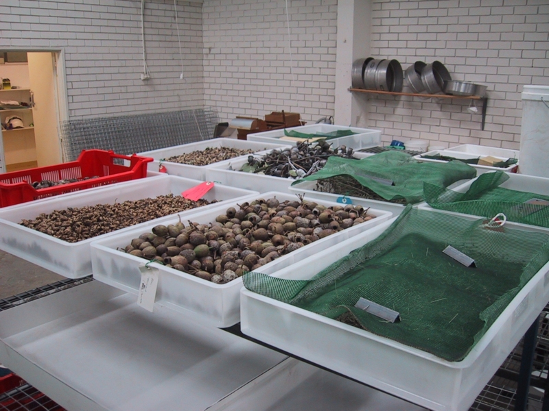
The seed drying trays in use at Tranen – a big part of what they do to collect seed for future restoration
Damian and the team are quite innovative, too – from being the first company being accredited under the Revegetation Industry Association of WA through to investigating the use of drones (under the new CASA drone regulations) to help with their monitoring of their revegetation projects.
We helped them to be innovative way back in 2011, when we first helped set them up with QGIS. At that time, QGIS was relatively unheard of in Western Australia. However, we had been doing a fair bit with it behind the scenes and it seemed like the perfect fit for their needs (especially because of the price tag of $0!). In this project, we connected QGIS up to their custom database (they are the mystery client behind this old blog post), using a custom bit of configuration we developed for them, and a couple of mapping templates for them to use. This way, they could readily see their data in map form; and from this minimal investment a significant benefit could be realised.
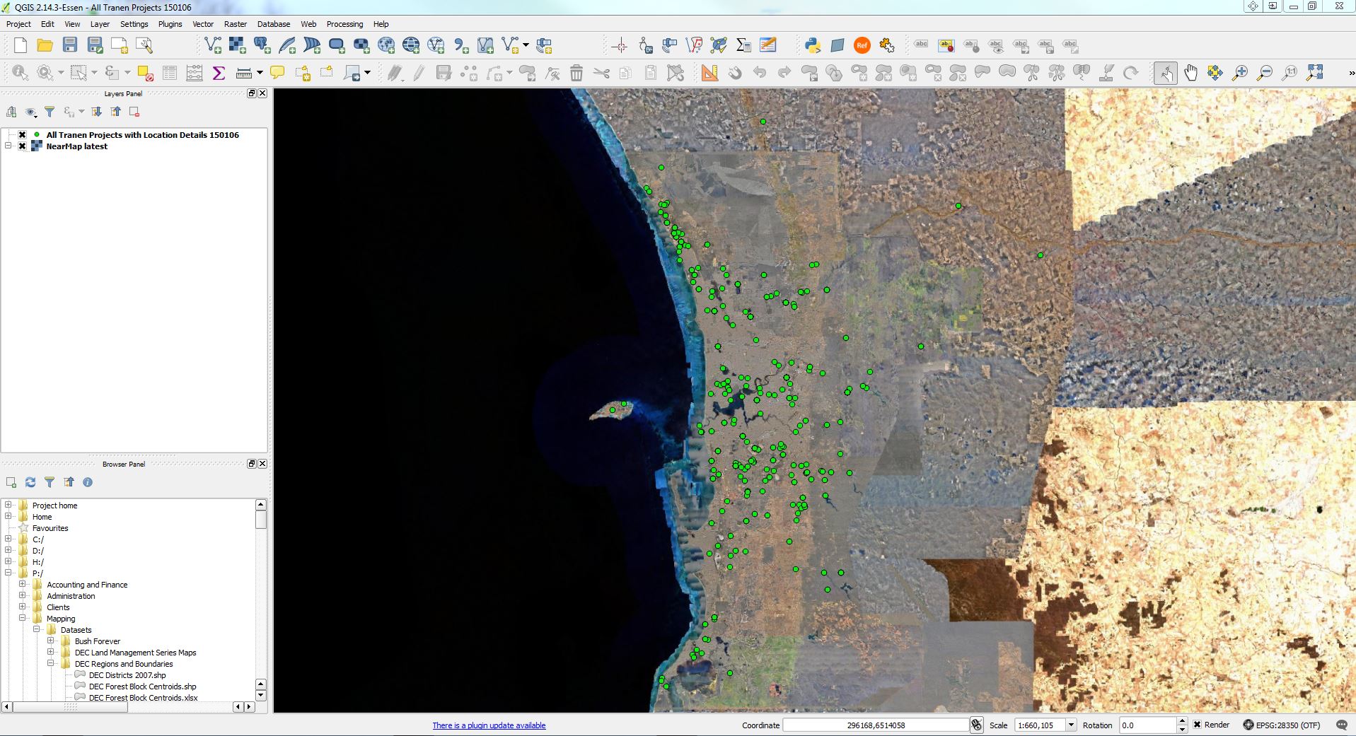
Tranen uses QGIS to monitor their distribution of projects
QGIS still performs well for them and continues to be a core part of their business, even with changes to their business systems (such as the replacement of the Access database with a SQL server version). QGIS has matured over the years and, like we did back in 2011, we would still recommend it as part of a solution for our clients that need a desktop package (and we do so with many of our Natural Resource Management projects in particular).
Damian and I spent some time catching up on the sorts of things that they do, and came up with a few additional simple things that can help them even more – from identifying a few new datasets (like MapBox imagery and fire mapping data), through to a few other issues that we cover in our Environmental QGIS training course. It was great to catch up with Damian and to remind myself about what they do (and I got to live a little vicariously through the discussions about field work, which I still miss).
It’s really part of our core mantra here at Gaia Resources that our solutions are not only responsible, but sustainable. To see one of our projects still delivering benefits over 6 years later is a great outcome for us – and for our client.
If you’re interested in QGIS, training or just want a chat about your systems and productivity, leave a comment below, contact us via social media (Facebook, Twitter or LinkedIn) or give me a call on (08) 92277309.
Piers
Comments are closed.