During the first weekend of October I took part in NASA’s Space App Challenge, also known as “the world’s largest hackathon”. This virtual event takes a collaborative approach to problem solving where teams aim to produce solutions to NASA defined challenges that we currently face here on Earth and in space. A total of 11 teams participated from Perth, but there were many more participants from 162 countries and territories. In the span of 48 hours, 2814 projects were generated around the world!
From the remote sensing related challenges, one of them particularly caught my attention: Identifying risk with science + communities, focusing on landslides. The challenge consisted of developing a tool using data from NASA satellites and ground-based sources to determine the risk of landslides in rural communities, and share the results with local communities and governments. I spoke to some friends about this, we decided to participate and registered as a team: the Landslide Detection Squad.
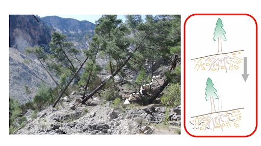
Trees tilting due to the effect of rock/soil sliding. Image credit mdpi.com
Before the event there was an information night held by Space Hub Perth and Core Innovation Hub, where speakers from BINAR, ICRAR and previous winners of the hackathon from Perth answered questions and gave us an insight of the current spatial situation in WA and Australia. It was a good chance to get motivation for working on spatial topics.
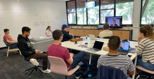
On the day of the hackathon, the team gathered at UWA Venture, excited to start the challenge. We kicked off by pitching some ideas and brainstorming on a white board, until we came up with what would be our project. Our objective was to detect the early stages of a landslide, with the purpose of warning the population living in risk areas. We needed to identify a parameter to measure that would indicate some kind of movement on the ground, so we chose trees. On forested slopes, tilting of trees and change in canopy structure can indicate soil and rock movement is occurring, which is a precursor to landslide events. Due to the use of remote sensing data, our tool could be applied in forested areas prone to landslide occurrence at a low cost.
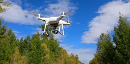
Remote sensing data provides a low cost option to detect changes in canopy structure. Photo Credit

Taking advantage of new sensors (e.g. cubesats and UAVs) providing high-resolution images and deep learning technologies for tree detection, we proposed and prototyped a method that detects a canopy movement on slopes that is indicative of landslide risk. This information could be used to enhance landslide risk models and is embedded within a system that generates dynamic risk maps, publishes alerts when situations are critical, and supports government agencies to plan ahead for emergency situations.
Spending the weekend doing something for science might not sound attractive to everyone, but it has its rewards! Chris from Gaia Resources, who was very supportive of my participation, suggested making this hackathon part of my professional development plan with the company. Taking part in this event allowed me to network with people from different backgrounds who are interested in the space field. As a team, we learned about landslides and prevention systems, and got the chance to build a new model which could help prevent disasters.
However, that is not it: our team came first in Perth and our project will be competing in the global round! Now it is a matter of waiting for the global results. Even if we do not win, taking part in a hackathon was a great experience and I encourage everyone to try it!
Have you ever participated in a hackathon? How did you find the experience? Please share in the comments, or start a conversation with us on one of our social media platforms – Twitter, LinkedIn or Facebook.
Rocío
Comments are closed.