Over the last couple of years, Gaia Resources developed a desktop app for the team at Wildlife Drones to act as a field mapping application for the real-time display of (radio frequency) tagged animal locations monitored by drone. The desktop app delivered imagery and mapping layers available for offline and online use and included the ability to synchronise collected data to a central database when back within mobile range.
More recent work focused on improvements in real-time data display of the drone position and radio tags, offline base-map useability and back-end data processing. Wildlife Drones have presented their integrated solution to conferences around Australia, and have a growing client base where our desktop app is a critical component contributing to important wildlife conservation efforts and research.
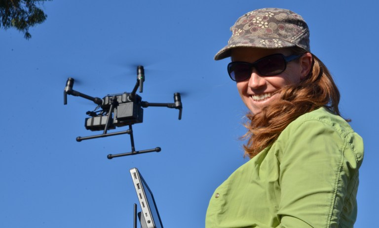
Debbie Saunders demonstrating the Wildlife Drones method
Dr Debbie Saunders, CEO of Wildlife Drones, gave us a great wrap:
“Gaia Resources did a wonderful job turning all our user interface ideas into reality. Within a relatively short period of time we went from having a general idea of what we wanted to having a very impressive, incredibly user friendly and intuitive user interface. This has dramatically increased our ability to demonstrate our technology to anyone who is interested. All the feedback from customers, investors and the broader community has been overwhelming positive and we are also now thoroughly enjoying using our cutting edge technology with much greater ease.”
Wildlife Drones are currently working on a project looking at the differences in behaviour and movement of Koala (Phascolarctos cinereus) in burnt and non-burnt environments. In this recent article, Debbie says:
“Usually when you are tagging wild animals there are always some that disappear, there are always some that take off. You end up spending all your time and effort looking for the missing animals. When you are on the ground with a handheld receiver, you’re tracking one animal at the time, you’re taking hours. With the drone we can track [the signals of] 40 animals at the same time, we could see all of the koalas all the time.”
In the aftermath of last summers devastating bushfires there is a lot of work going on in New South Wales and Victoria to monitor remaining populations of Koala and drones are playing a crucial and time-saving role in this research.
Over much the same timeframe, Gaia Resources has been working with the NSW Department of Planning, Industry and Environment (DPIE) to develop another approach to monitoring Koala populations, via the I Spy Koala citizen science app. There is clearly a role for both approaches to help save our dwindling Koala populations, and perhaps there may be some synergy between them.
More information about this project can be found in our blogs and project page. And you can hear more about Wildlife Drones direct from Debbie in this upcoming Environmental Institute webinar.
If you’d like to discuss any of the topics covered in this post, please drop me a line at alex.chapman@gaiaresources.com.au, or connect with us on Twitter, LinkedIn or Facebook.
Alex
Comments are closed.