Have you ever wondered how AI is transforming the landscape of geospatial technology? What role do drones play in enhancing remote sensing capabilities for environmental monitoring? And how can open-source solutions foster collaboration and drive innovation in our industry? At the recent ISPRS and FOSS4G conference in Fremantle, we explored these fascinating topics and more.
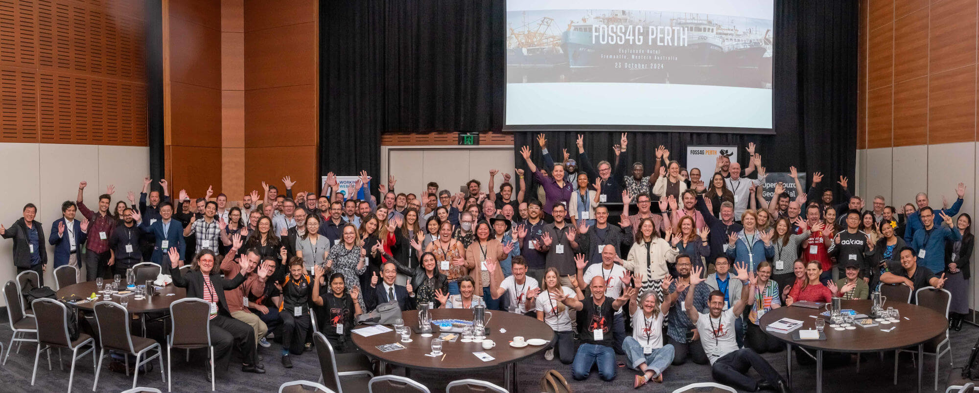
Last week Jake and Rocio, part of the Data Science team at Gaia, had the opportunity to attend the ISPRS (International Society for Photogrammetry and Remote Sensing) and FOSS4G (Free and Open Source Software for Geospatial) conference. This event brought together professionals, researchers, and enthusiasts from around the globe, all eager to share insights and innovations in the field of geospatial technology.
The ISPRS Symposium had a wide variety of themes, and we were particularly interested in hearing more about openness in geospatial sciences and remote sensing, global mapping for SDGs and human behaviour and spatial interactions, amongst others.
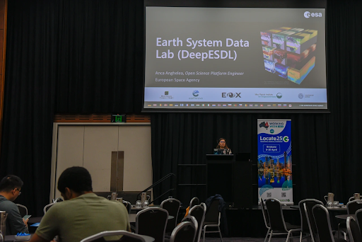
The event started on Tuesday and was split between tutorials and the symposium kick-off. Jake attended Tutorial 3 - Uncovering Earth System Dynamics with multivariate EO Data and AI. This hands-on training introduced us to the DeepESDL (Deep Earth System Data Lab), and made practical use of this AI-ready, collaborative environment. We were guided to explore the capabilities of the DeepESDL including the creation of data cubes from open earth observation datasets, applying various data analysis techniques and exploring AI approaches to extract information from multivariate datasets.
Tuesday’s official kick-off at the Esplanade Hotel in Fremantle began with a keynote on Drones and AI in remote Australia, where some really interesting programs and research are being conducted to monitor all sorts of fauna and flora.
On Wednesday, the spotlight was on FOSS4G, highlighting the latest advancements in open-source geospatial technologies. The day was filled with sessions that showcased innovative tools and best practices. At Gaia, one of our core values is supporting open software and open data, which is why we were proud to be sponsors of the event. It was exciting to hear the presenters' experiences and discussions on how FOSS4G fosters collaboration and drives meaningful change.
Thursday and Friday was a mix of ISPRS talks and panel discussions. We really enjoyed hearing how academic and industry people alike are utilising geospatial data and methods for various use cases. The panel discussions and debates were a highlight too, which brought together a wide range of backgrounds and experience from academic institutions, government and private organisations, and ISPRS committee members.
To wrap it up, on Thursday evening we attended a dinner at Gage Roads Brewery. It was the perfect opportunity to unwind, enjoy some drinks, and grab a bite while connecting with fellow attendees.
A couple of questions to summarise…
Did you attend any sessions that stood out to you?
JG: One that stood out to me, and has been a pain point in the spatial world, was AI and collaboration in the future of geospatial. It was a mixture of the huge amounts of earth observation data that we do not analyse (a whopping 99%!) and the current pitfalls of collaborative tools available for geospatial.
RP: We had the pleasure to hear many great speakers, but I particularly enjoyed a session on automating property parcel classification using multi-modal deep learning and another one about systematically recording water trees in south WA using an agent-based model.
What open-source tools are you looking forward to exploring?
JG: There are so many that I would love to delve deeper into. Ones that instantly come to mind are open source software working seamlessly with one another to create a full GIS suite (QGIS, PostGIS, DuckDB, GeoServer, LizMap GeoNode, QGIS Cloud).
RP: I’m very excited about exploring some open source web mapping tools I heard about during one of the lightning talks from FOSS4G, like GeoNode. The dashboard and stories capabilities from this application sound amazing!
ISPRS and FOSS4G 2024 gave us a fresh look at how AI and open-source tools are driving real change in geospatial tech. The conference highlighted some exciting possibilities for the industry. It was inspiring to meet so many people dedicated to pushing the boundaries of what’s possible with geospatial data. We’re pumped to bring these insights back to Gaia and explore new ways to support our community.
If you would like to know more about our geospatial services please don’t hesitate to contact us or start a conversation with us on one of our social media platforms LinkedIn, Facebook or Instagram
Jake and Rocio