Overview
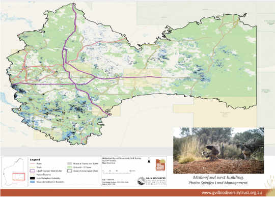
As published in the Winter 2018 Great Victoria Desert Biodiversity Trust newsletter, Gaia Resources worked with the Trust to develop target corridors to use to commission LIDAR capture across the region, in order to be used to identify Malleefowl mounds in the area, and we described the technical approach in our blog. This project builds upon our previous analysis work finding the likely sites for Malleefowl (see this project summary). This project involved taking the results of this previous analysis and using them to find the most suitable corridor for data capture to occur in which covers the most likely areas for the mounds to occur.