Overview
In May of 2017, Gaia Resources were engaged by the Wagin-Woodanilling Landcare Group in a small project to add interactive maps to their WordPress website. This involved adding an open-source Leaflet plugin for WordPress, configuration of web map services (or spatial data layers) onto five separate web map pages on their site, and handover training to staff.
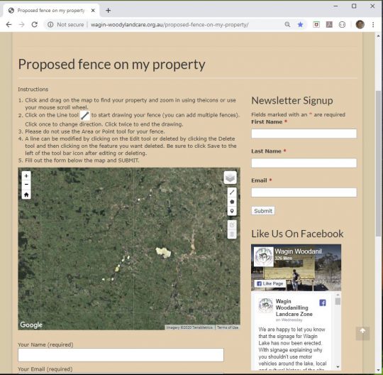
The Proposed Fence on My Property web map page is an example of one of these interactive maps. It provides a workflow for landowners to lodge an expression of interest by marking their fence on a map and filling out form details. This submission starts a conversation with the Landcare Group where they can obtain land management and conservation advice, and look at options for other means of support.
Most of the web map services are maintained through the South West Catchment Council’s GRID application (Geographic & Reporting Information Database), and Wagin-Woodanilling are one of many landcare and community groups that use GRID to support their Natural Resource Management activities.
Services
GRID / Spatial / Training / Web development