Gaia Resources was engaged by the State Records Office of Western Australia (SROWA) in early 2019 to design and develop an interactive mapping system for the Perth Metropolitan Sewerage Scheme Plans (a Series within the State Archives). Last week, this was launched by the Minister, under the title “Retromaps“, and it’s already been getting a lot of traction!
As part of the project, the SROWA digitised and georeferenced 2,149 historical sewerage plans for the Perth area, thanks to a whole range of volunteers. These resulting georeferenced images are pretty large – around the 400MB mark each – and provide an unparalleled, highly accurate and high resolution snapshot of the Perth metropolitan area, from dates ranging from 1910 through to 1964.
There were a number of challenges associated with making these maps available in a way that is performant, but also clean and consistent to provide an exceptional experience for anyone using the site.
The Challenge
We needed to make sure that our solution had the following characteristics:
- Simple and easy to use for SROWA, their clients, and the general public,
- It has the basic map tools to navigate easily and efficiently, including search capabilities,
- It will show the plans displayed “in the real world” (i.e. on a mapping interface), and
- The mapping interface should also show current satellite imagery.
In addition to these basic requirements, we also wanted to make sure that the solution:
- Delivered the plans in way that is most useful to as wide an audience as possible,
- Will be expandable to be able to add in other map series if they become available,
- Represents exceptional value for money in both the creation of the system and the ongoing maintenance of the system for SROWA, and
- Works with the existing investments that the SROWA have put into their internal systems.
No small challenge, and there were a couple of problems to deal with along the way…
The Problems
The first problem was reducing 2,149 large images (400MB) without losing the high resolution quality. So, we used some pretty handy spatial software tools and developed a bunch of scripts to help deal with the volume of images and reduce the size (on average) to around 3 – 4% of the original image – with minimal loss of resolution. We also put the site online using infrastructure from Amazon Web Services – which means we can scale it up really easily if the demand requires it (and in the meantime, it’s great value for money!).
The second problem, and the most time sapping task, was to deal with the “overlap” between the maps. Each of the raw original plans overlaps the ones near to it (see figure below), so we needed to get around this to create a seamless mapping layer.
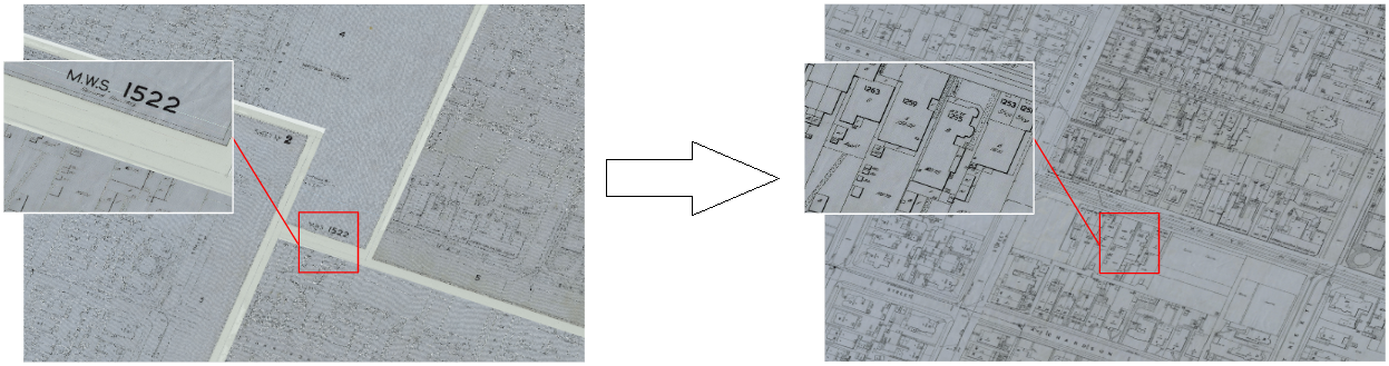
The maps when overlaid on each other block out parts of the map, so with our solution we had to remove these to make them more useful as a seamless layer.
We did this by digitising the “real world” boundaries of the maps (where there were actual features to see) and after some final checks and quality control we could now start stitching everything together. Creating a seamless layer involved multiple spatial scripts and more free and open source spatial tools. After a run through of the scripts, we had a nicely tiled map layer, all ready for use on the web.
But of course, you still need to be able to download the individual map tiles so that you can see all the important marginalia on the sides of them (like the date of the map) so we also were able to allow the maps to be individually downloaded from within the site itself.
Putting it together
The resultant Retromaps website was designed and developed to cope with the problems we had identified and delivered on the challenges we had set ourselves (and SROWA set us). The resultant web site has seen a lot of people already signing up – there were over 7,000 people signing up on the first Saturday it was out, thanks to the launch being shared across a whole range of sites on social media.
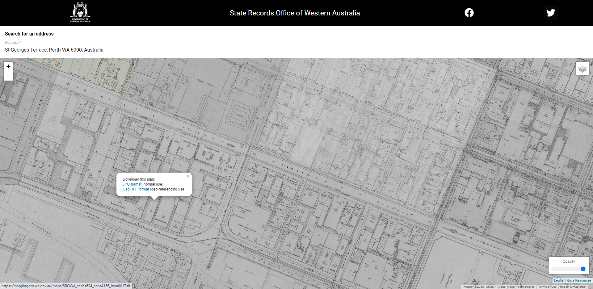
An example of the sorts of detail and maps that you can see within the site – but go visit it for yourself!
When SROWA first approached us about this project, it was a bit of a dream job and a labour of love for us – we’re all about archives and spatial so to get the chance to pull these together has been a great opportunity. It was something that we’ve been thinking about for some time (since our blog in 2015, “Hacking the Archives“) and it was great to see it come to fruition.
If you’d like to know more about RetroMaps and our work in archives or mapping (or both!), please leave a comment below, connect with us on Twitter, LinkedIn or Facebook, or email me directly via jake.geddes@gaiaresources.com.au.
Jake
Comments are closed.