
Environment

Working with our clients to protect and
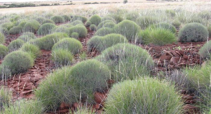
improve the natural environment

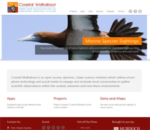
Gaia Resources has always worked in the environmental field, since our inception, and we’ve provided a wide range of technological solutions to clients over since then.  We provide a range of different services to the environmental field, including:

  • Strategy Development - with over 20 years of operations, applying our expertise to help you develop environmental strategies around your technological needs,
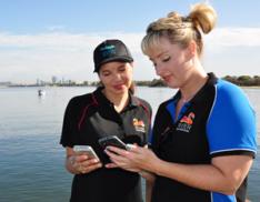
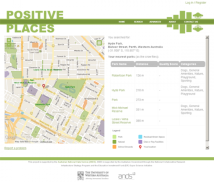
  • Spatial Services - we can undertake project-based spatial analysis work, where we can deliver a holistic solution to you through our in-house team, or we can provide on-site or remote spatial support for your business, 
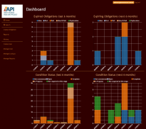
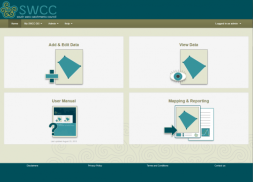
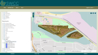
  • Software Development - across the full Discovery, Design, Develop, Test and Deploy cycle we utilise, we can deliver software across a range of different platforms and languages,
  • Support - we operate an enterprise level help desk service that can be used to support the systems you operate,  
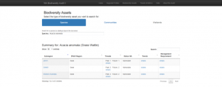
  • Data Science- with a raft of expertise in biodiversity and other environmental data, we specialise in helping our clients get the maximum value from their data, and
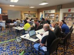
  • Training - we run training in the open source package Quantum GIS as both commercial courses and through a freely available online training course.
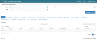
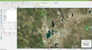
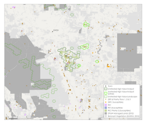
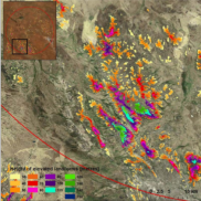
These services have been delivered across a range of different organisations to deliver a wide variety of environmental technology solutions, as can be seen from the projects shown on the map and list below.

Biodiversity Audit

Our team worked with others within the Department of Parks and Wildlife to build a decision support tool using the the 2014 Parks and Wildlife Biodiversity Audit data. The tool provides users with the ability to quickly gain a regional snapshot of biodiversity issues as well as providing access to the raw data collected during the audit.  This was a short project with a tight deadline and budget, and so the use of existing systems (such as CKAN) within the Department’s infrastructure was a key factor in it’s success.

Custom QGIS Training

Gaia Resources have been offering a range of training solutions in the open source spatial software, Quantum GIS (QGIS).  We have run cost-effective, customised training courses for clients across Western Australia, covering the usual content in our commercial training course but either tailored for the client (e.g. focusing on specific areas more than others as driven by their business needs) or simply by running the training in their premises.

Knowledge Management Initiative

Gaia Resources was involved in the Office of Information Management’s (OIM) ongoing program to improve digital information management tools within the Department of Parks and Wildlife.  This project used open Information and Communications Technology (ICT) ecosystem principles and architecture to enable and protect data collection, storage and access mechanisms for internal (and potentially external) users within the Department.

Environmental Compliance System

Gaia Resources developed a new web-based Environmental Compliance system for the Australian Premium Iron Ore Joint Venture, allowing the environmental officers to lodge, manage and report on a range of different environmental regulations for their West Pilbara operations.

The system allows for the environmental staff at API to create new compliance requirements, search through the existing ones and to provide reports on the current status of compliance reporting, including charting (like the example shown here, using test data) and other reports.

Dolphin Watch

As part of the Coastal Walkabout citizen science hub, we have developed and deployed a mobile App for the Dolphin Watch project, for both Android and iPhone devices, and in March, 2017, we released a new version, rebuilt from the ground up.

This project initially involved the creation of a new Dolphin Watch App for the project, which was based on the Coastal Walkabout App, but with two major changes;

Marri Canker

Gaia Resources worked with Murdoch University’s Plant Pathology group to develop an app for recording Marri Canker disease around Western Australia.  The Marri (Corymbia calophylla) is an iconic tree species and plays a major role as a food source, habitat tree and refugia for numerous vertebrate and invertebrate fauna, as well as being a key species for southwest beekeeping and honey production.  Cankers are a symptom caused by the death of areas of

Marine Remote Sensing

This project investigated the methods, results and discussion of an approach to using remote sensing to delineate Benthic Primary Producer Habitats (BPPH) and Mangrove Habitats in a coastal Pilbara region.  The aim was to determine the suitability of a range of different satellite imagery platforms for delinieating BPPH and Mangroves and to monitor their change over time.

Woodside Spatial Support

Over a number of years, Gaia Resources seconded staff to Woodside Energy to provide a range of spatial services both in an on-site secondment role, and also through the provision of projects looking at topics ranging from the auditing of existing data, definition of environmental data standards through to overflow spatial mapping tasks.  These projects have given us a good overview of the oil and gas industry, and build upon work we are doing elsewhere in the environmental data standard space.


Coastal Walkabout

Coastal Walkabout was an open-access citizen science initiative that we partnered together with Murdoch University and utilised smart-phone technology and social media to engage and motivate local communities to gather scientific observations within coastal and estuarine environments.

The Coastal Walkabout project was a development project that Gaia Resources were involved in throughout 2013 an in subsequent years. Gaia Resources deployed our now-deprecated BDRS product for the Coastal Walkabout project, and also developed Android and iPhone apps for the project.

Biodiversity standard review

Gaia Resources were initially engaged by BHPIO in 2008 to provide a field collection solution, and again in 2012 to review and redevelop a comprehensive Biodiversity Survey Spatial Data Standard.  

A phased approach was used which started small with the hiring of single TDS Nomad PDAs with ESRI ArcPad to test the technology. When this trial proved to be successful BHP purchased three Nomad units and requested the creation of a Weeds Data Standard and custom data collection forms for ArcPad. User training was also delivered onsite to the BHP environmental staff at Newman.

South-West Australian Ecoregion Initiative

The South-West Australian Ecoregion Initiative’s (SWAEI) Conservation Planning Project was a long-term (18 month) project, where our team was involved to deliver all of the spatial and technical analysis for this project.  Using desktop GIS software, specific software such as Marxan and other tools resulted in the delivery of a wide range of different conservation scenarios for the south west region.  This project is summarised in both a scientific report and a

Telfer Mesa Detection

Newcrest Mining contracted Gaia Resources to undertake an investigation of elevated landforms (primarily mesa formations) around of the Telfer minesite – covering 2.5 million hectares of land.

An approach was developed that looked at both manual detection and automated classification using a Digital Elevation model, derived from remote sensing data.  After an initial trial on a smaller test area, the automated classification was then run across the entire area.

Volumetric Calculations from Remote Sensing

Gaia Resources worked with St Barbara Limited to undertake disturbance and rehabilitation summaries, and extended this to look at the calculation of the volumes of waste dumps.  With all of these components, remotely sensed data was used in the form of both imagery and Digital Elevation Models.

For the waste dump calculations, the Digital Elevation Model was used to calculate the volumes of the waste dumps through a process to pull out the base level of the surrounding topography, and then to calculate the volume of the dumps based on their shape and height.

Birds in Backyards

Gaia Resources has supported the Birds in Backyards project since 2011.  This project has involved working in an existing Drupal framework to maintain the web site and to continue to provide technical support to the team behind the project, based in Sydney.  Over time this has included providing advice and assistance on a wide range of technical issues including migrations, upgrades, hosting solutions, data management and reporting.


Tranen Revegetation Systems – Spatial Implementation

Back in 2011, Gaia Resources implemented a new spatial mapping system based on QGIS for Tranen, that linked to their customised database to map and display information about their revegetation projects. The implementation included the development of this linkage, several mapping templates and a restructure of their corporate GIS data stores. The system is still in use to this day, and we revisited it in 2017 to produce the blog at https://www.gaiaresources.com.au/using-qgis-environmental-restoration/.

Atlas of Living Australia

Gaia Resources’ Director, Piers Higgs, was appointed as the Citizen Science Team Lead for the Atlas of Living Australia (ALA) back in 2010, and led the ALA’s citizen science efforts, including the development of the Biological Data Recording System (BDRS).  This involved frequent travel to Canberra, along with a wide range of duties meeting with external groups, and implementing the BDRS for a wide range of projects under the ALA’s auspices.  Following on from this contract, Gaia

Biodiversity Snapshots

The Biodiversity Snapshots project was implemented by Gaia Resources using our BDRS system, with a custom mobile tool developed for the project.  This project aims to assist students and teachers to field trip and report on their local fauna, across a broad range of environments in south-eastern Australia, including urban, bushland and coastal areas.  Gaia Resources initially developed this under the auspices of the Atlas of Living Australia, and then went on to provide additional support to the project, including h

Get in touch with our team

enquiries@gaiaresources.com.au