Environment

Working with our clients to protect and
improve the natural environment

Gaia Resources has always worked in the environmental field, since our inception, and we’ve provided a wide range of technological solutions to clients over since then.  We provide a range of different services to the environmental field, including:

  • Strategy Development - with over 20 years of operations, applying our expertise to help you develop environmental strategies around your technological needs,
  • Spatial Services - we can undertake project-based spatial analysis work, where we can deliver a holistic solution to you through our in-house team, or we can provide on-site or remote spatial support for your business, 
  • Software Development - across the full Discovery, Design, Develop, Test and Deploy cycle we utilise, we can deliver software across a range of different platforms and languages,
  • Support - we operate an enterprise level help desk service that can be used to support the systems you operate,  
  • Data Science- with a raft of expertise in biodiversity and other environmental data, we specialise in helping our clients get the maximum value from their data, and
  • Training - we run training in the open source package Quantum GIS as both commercial courses and through a freely available online training course.

These services have been delivered across a range of different organisations to deliver a wide variety of environmental technology solutions, as can be seen from the projects shown on the map and list below.

IGO Disturbance and Rehabilitation Tracking

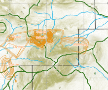
Gaia Resources were engaged by the Environment team at Independence Group NL (IGO) to develop a prototype system for ground disturbance and rehabilitation tracking. Initially this involved a review of Environmental Regulations in different States across Australia, followed by system development using existing technologies and resources. The project was aimed at more accurately defining disturbance and rehabilitation for environmental reporting purposes.

IGO Spatial Data Management

The Gaia Resources GIS team has been working with the mining company Independence Group NL (IGO) throughout 2017-18 to help transform spatial information management, software and processes that are critical for their exploration activities. Gaia Resources were initially engaged to deliver a GIS Health Check report which assessed the current GIS environment, mapped out a future state with consideration of business requirements and industry best practice, and provided a set of prioritised recommendations and a road map for

Bushfire Planning

In early 2018, Gaia Resources were asked to provide GIS support and strategic consultancy to Bushfire Prone Planning (BPP). With a growing bushfire planning team in Perth, the BPP team needed to expand its use of GIS software beyond the 1-2 analysts based in remote offices. We provided initial advice to help them understand the benefits and limitations of using the free and open source GIS package QGIS across their business.

LIDAR Corridor Assessment

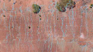
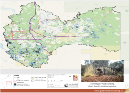
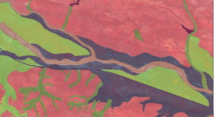
As published in the Winter 2018 Great Victoria Desert Biodiversity Trust newsletter, Gaia Resources worked with the Trust to develop target corridors to use to commission LIDAR capture across the region, in order to be used to identify Malleefowl mounds in the area, and we described the technical approach in our blog.  This project builds upon our previous analysis work finding the likely sites for Malleefowl (see this project summary

Researching floristics and bees with CRCHBP

Gaia Resources has been working with the Cooperative Research Centre for Honey Bee Products (CRCHBP) via secondment of our staff to work with the researchers involved in the project.  Alex Chapman, one of our Consulting Scientists, works with the team based to deliver a range of research and services, based on his experience in Western Australian floristic taxonomy and with the support of the rest of the Gaia Resources team.  Alex is seconded to work with the Program 1 team, to design and develop a spatiotemporal information s

Blackwood Basin Group website enhancements

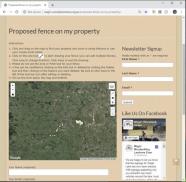
In 2018, the Blackwood Basin Group (BBG) engaged Gaia Resources on a small project to enhance its website with the inclusion of an interactive map feature where landowners could submit project proposals for fences, planting or flora and fauna sightings. The Blackwood Basin Group is a non-profit, community-based organisation that coordinates environmental management within the Blackwood River Catchment in Western Australia.

Marsden Jacob GIS Support

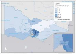
Gaia Resources started supporting Marsden Jacob in late 2017 with a small project to create GIS mapping output showing aged care facility data in Victoria across local councils.

The task involved sourcing of data such as facility locations and accommodation figures from the Australian Bureau of Statistics and the Victorian Government. ArcGIS was utilised to create a series of maps to support a larger report and recommendations to a government department.

OEPA GIS Health Check

In mid 2017, the Office of the Environmental Protection Agency (OEPA) approached Gaia Resources to review its GIS environment. The GIS team at OEPA wanted to have a closer look at data management, software, hardware, standards and processes to realise efficiency and quality benefits within their environmental approval workflows.

Biologic fauna habitat data cleansing

Biologic engaged Gaia Resources in late 2017 to provide quality control and data management over their Pilbara region fauna habitat dataset on behalf of a major Perth-based Resources company. The work involved QGIS and ESRI ArcGIS software to cleanse topological errors and merge years of historical survey boundaries into a master dataset. Small overlaps and gaps in the data resulting from past processes and mapping exercises needed to be resolved before the data could be accepted by the ultimate client and incorporated into their enterprise GIS system.

EMRC GRID

We worked with the Eastern Metropolitan Regional Council (EMRC) to implement an instance of our GRID web mapping solution to support their programs and community groups.   This was a ‘standard’ GRID rollout project – we helped set up their data templates (Activities, based on those from other groups), their contextual data (base layers), and then ran hands-on training for EMRC staff and a range of their group members.

Wildcare Helpline

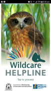
We worked with the Department of Biodiversity, Conservation and Attractions to develop the Wildcare Helpline app, which supplements the Departments volunteer Wildcare Helpline telephone service.

The app contains two main components – a listing of organisations that can help with wildlife care, which is displayed in geographic proximity to your location.  This listing includes phone numbers and locations to that you can find them quickly and easily.  In addition, a range of other information on what to do if you find native animals is also included in the app.

Malleefowl Site Selection

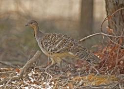
Gaia Resources was engaged in January, 2017 by the Great Victorian Desert Biodiversity Trust (GVDBT) for a project to identify survey sites for the threatened species – Leipoa ocellata, or Malleefowl, commonly also known as ‘Nganamara’  –  in the Western Australian half of the Great Victorian Desert. The objective of the site selection study and surveys (to be carried out in early 2018) is to test a set of hypotheses and to learn more about this elusive species’ habitat.

Green Infrastructure Mapping

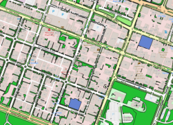
In mid 2017, Gaia Resources supported Syrinx Environmental on a project for the City of Perth to establish a baseline for urban vegetation monitoring in the City of Perth.  Our team provided key spatial data deliverables and analysis of imagery, property boundaries and verge definition through advanced GIS software tools and innovative analysis techniques. 

The baseline included characterisation of green spaces – in terms of amenities, facilities and habitat – throughout the city as a spatial dataset for ongoing monitoring.

Perth Parks and Green Space Survey

Following on from previous work on the Public Open Space (POS) Tool, Gaia Resources implemented a project using our SurveyEngine toolkit.  This project delivers a specialised web-based survey that allows for respondents to indicate their home address, and then to document their use of various parks.  The survey is customised to also enable some A/B Testing of the use of maps in these sorts of surveys; along with a custom back end that delivers a data download.

Black-Cockatoo Community Wisdom Survey

Gaia Resources delivered a custom web-based survey to Birdlife Australia for the Black-Cockatoo Community Wisdom Survey, which is an online survey built using our SurveyEngine toolkit.  This toolkit (which uses serverless technologies) enables us to create a survey that allows respondents to document their knowledge of three iconic species of Black-Cockatoo – Baudin’s Black-Cockatoo, Carnaby’s Black-Cockatoo, and the Forest Red-tailed Black-Cockatoo – all three of which are currently listed as threatened under both state and federal legislation.

State NRM GRID

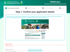
In early 2017, we worked with the State NRM Program to implement GRID within their organisation.  This setup was undertaken as part of the recent Capacity Building Grants and aims to not only assist groups in being able to more easily submit their grant applications, but also to provide a means for groups to gain access to this easy to use,online GIS for the NRM community.

Wildlife Licensing System

Our team have worked on a range of different projects with the Department of Parks and Wildlife over time, and in early 2017 we saw the launch of our work on the new Wildlife Licensing System.

This project included considerable analysis of the existing Wildlife Licensing System, which was nearing its end of life, and looked at how to replicate the required outcomes, but also to deliver on more efficient licencing for both the Department and the many clients that acquire licences from the Department.

Get in touch with our team

enquiries@gaiaresources.com.au